
Dugong Appraisal 5 min well review
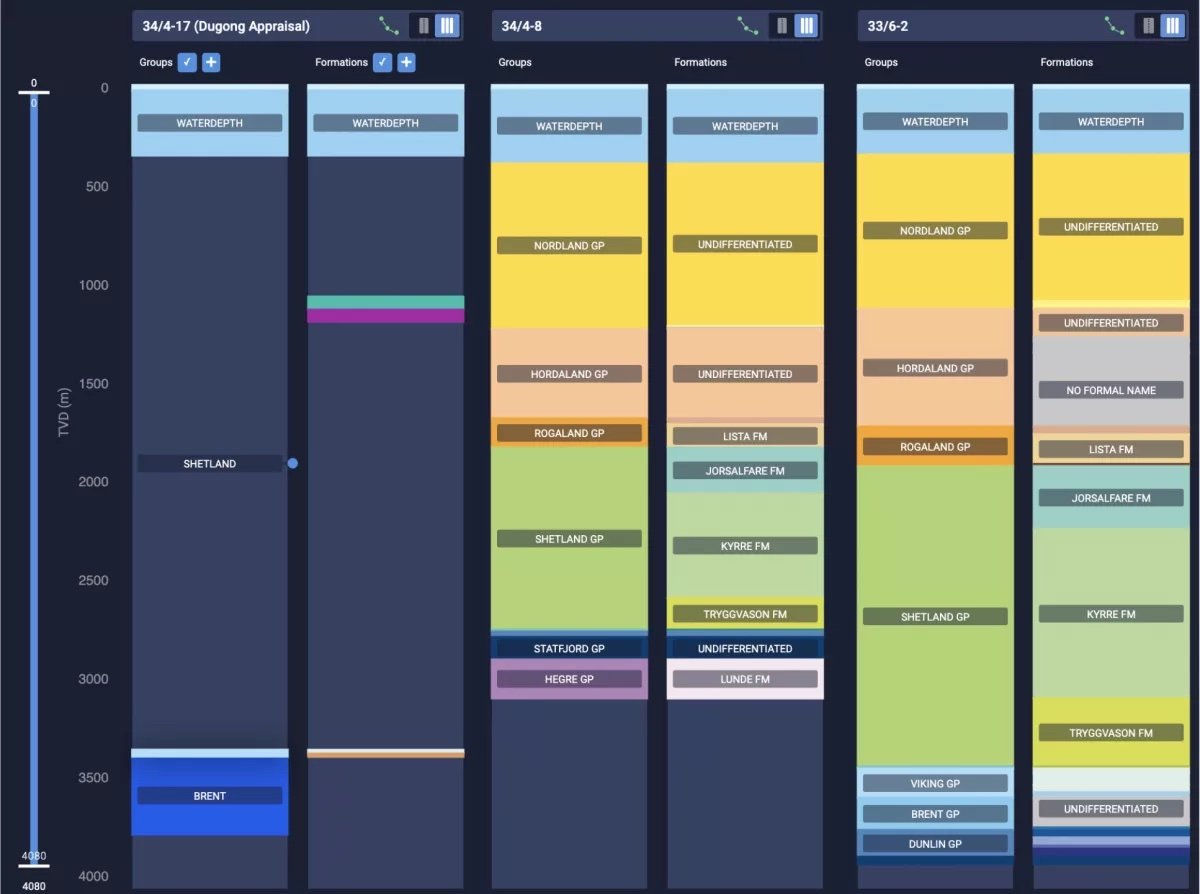
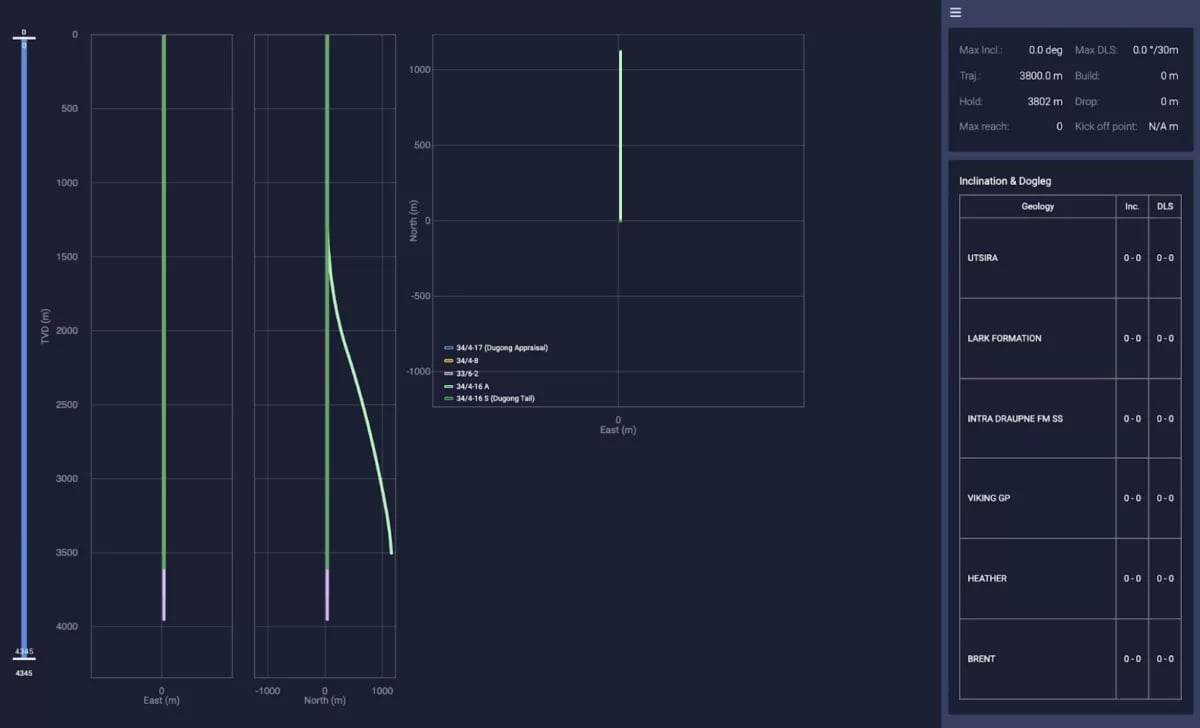
During 2020, Neptune received NPD approval to drill the Dugong Tail prospect in the license PL882. Two wellbores were planned, the vertical 34/4-16 S (drilled and currently suspended) and a side-track down-dip to the north. These wellbores will be followed by the Dugong appraisal 34/4-17. The purpose of this appraisal well is to drill through the sandstone formations Draupne (Viking Gp) and Rannoch (Brent Gp) and obtain data on the hydrocarbon potential and thus contribute to increased volume for the Dugong license. A well test (DST) will be performed to evaluate the dynamic reservoir deliverability.
How to use previous experiences from offset wells?
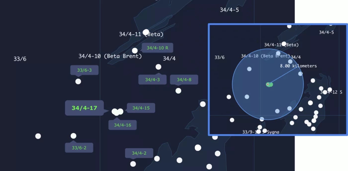
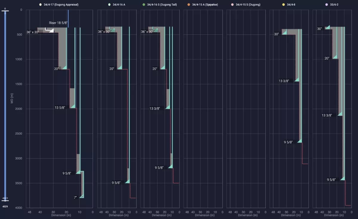
Near field exploration is a valuable business. You can tie-in to existing infrastructure for production and you have lots of offsets to work on. Within 8 kilometres of the planned well location (61°33'46.09''N, 02°01'57.74''E), we find 8 wellbores without considering the latest already drilled since the last year (34/4-15 S, 34/4-15 A and 34/4-16 S) and the planned side-track 34/4-16 A.
A quick look at the Geology
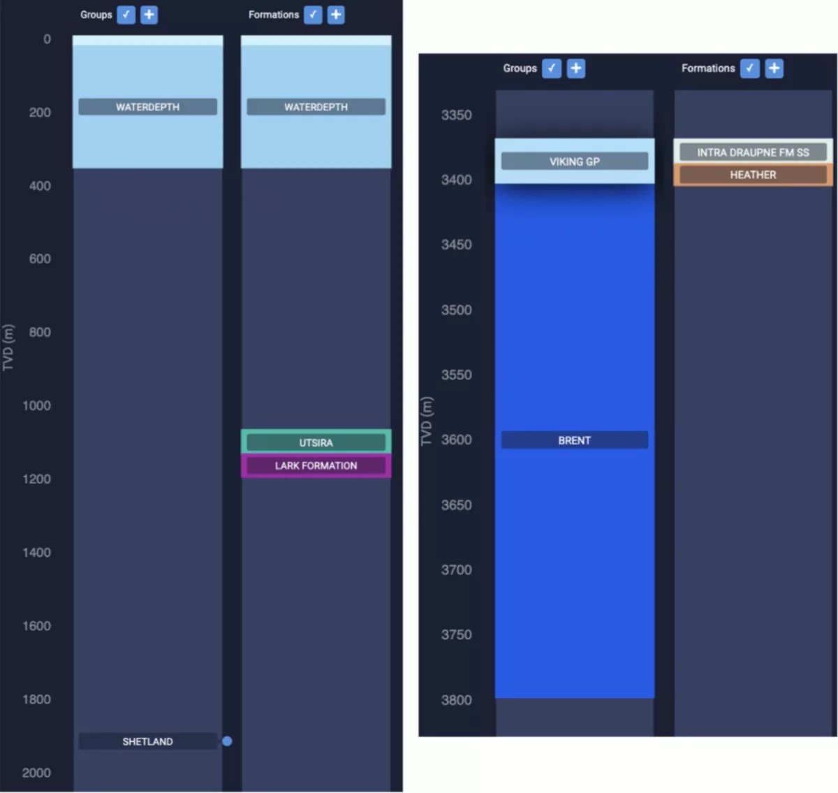
The discovery well 34/4-15 S and the down-dip sidetrack 34/4-15 A proved oil in the Viking and Brent Groups of the Dugong prospect, which consists of two reservoirs that lie at a depth between 3,250 – 3,400 metres.
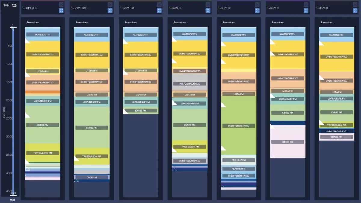
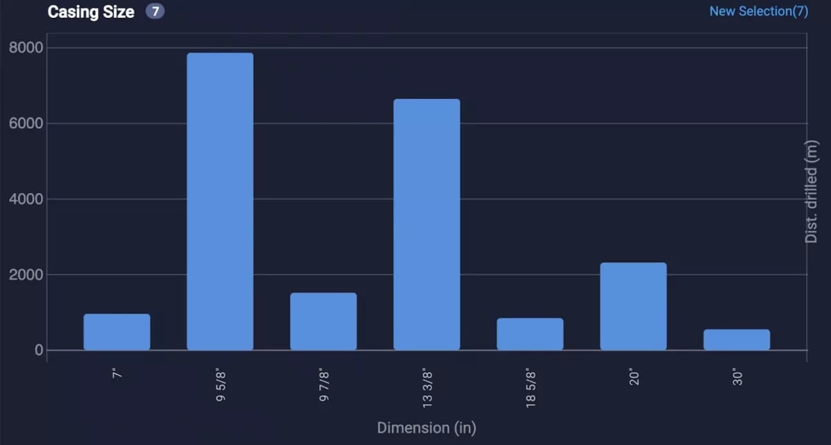
Defining hole sizes and drilling mud program
The upper hole sections of 42”x36” are planned to be drilled with seawater and bentonite and drilled down to 457 m MD. Water-based drilling fluid (WBM - Glydril) will be used in the 26" section together with foam cementation to the seabed. A 17 ½” hole is drilled down to 1,983 m MD with an oil-based drilling mud (OBM). OBM is used for the 12 ¼” section down to 3,311 m MD, and the deepest hole section of 8 ½” is planned to be drilled with OBM down to a depth of 3,800 m MD. The nearby wellbores 34/4-8 and 33/6-2 provide valuable PPFG data to run a decent comparison and quick check.
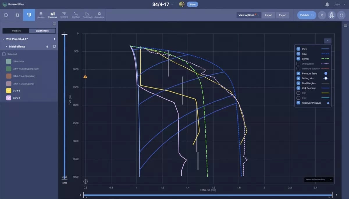
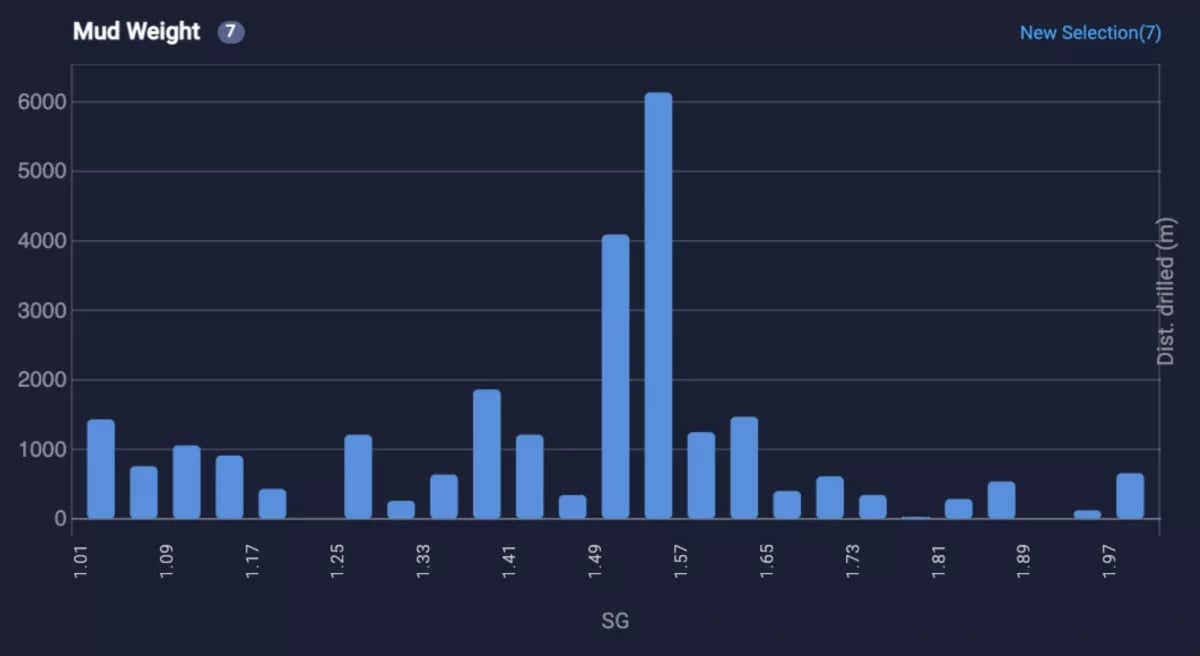
The mud program is expected to involve values of around 1.03sg for the shallowest section (42” hole), 1.25sg approximately for 26” hole section, then from 1.30sg to 1.42sg for the 17 ½” hole and a range of 1.42sg to 1.52sg for the next 12 ¼” hole section. Finally, the last section will be drilled with 1.48sg OBM. Mud weight data available from the offset wells indicate these are good enough ranges for this design.
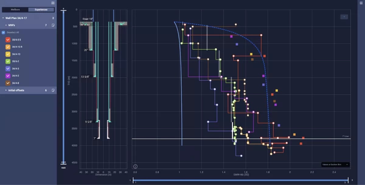
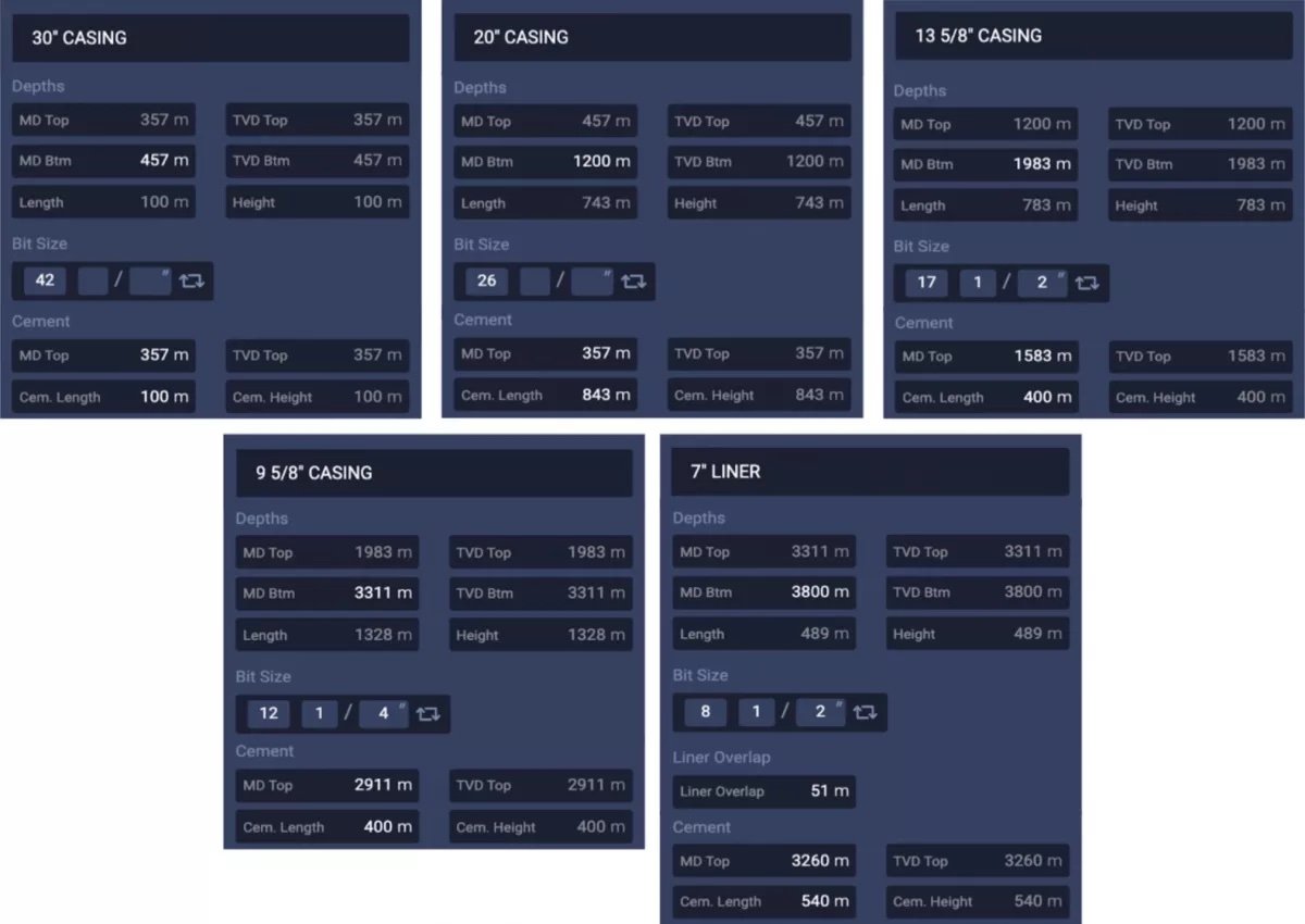
A better look at the wellbore sections
How long does this project is expected to take?
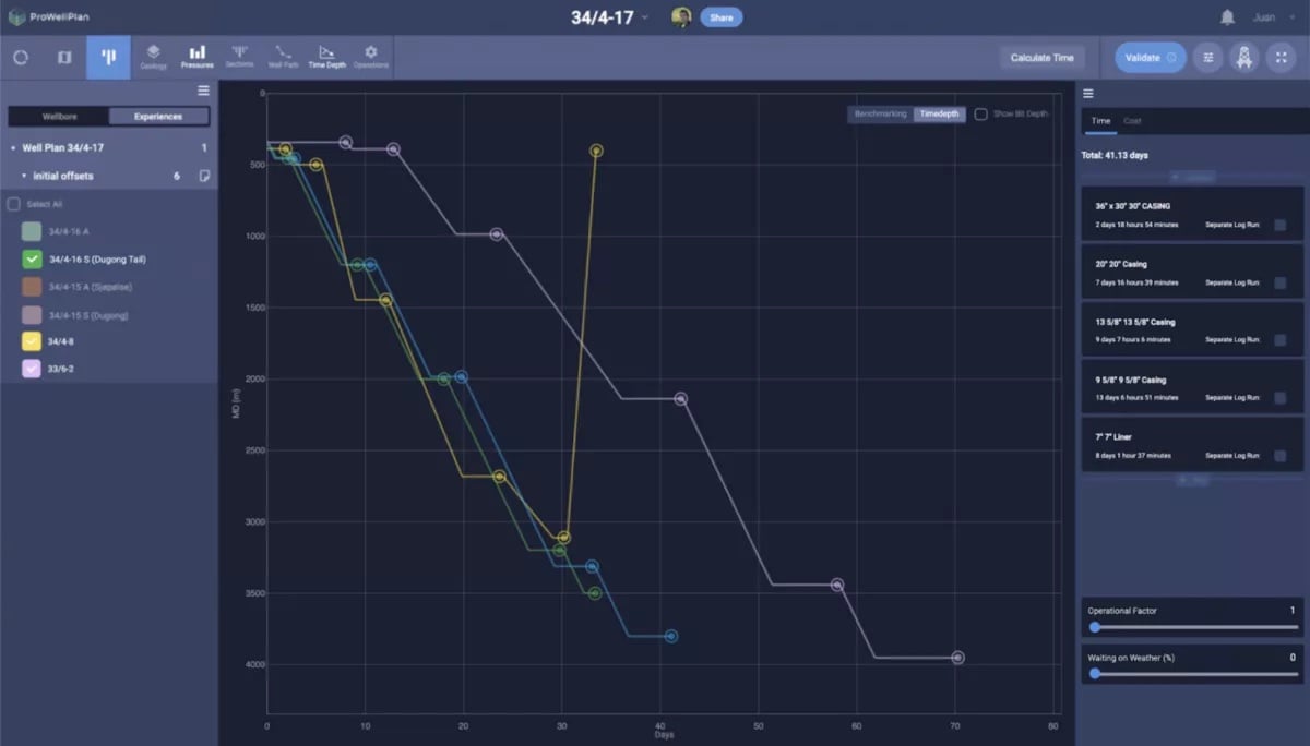
The well is scheduled to be drilled in about 71 days. In the case of a dry well, the drilling time is estimated at 41 days and in the case of discoveries, a well test is carried out with a duration of approximately 30 days. The well will be permanently plugged back (NORSOK D-010, 2013).
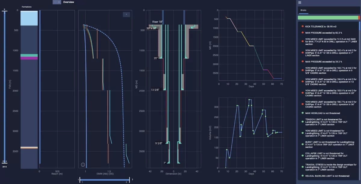
Did you see the risks with red markers? Well, some casing properties need some attention. But, that could be for a next occasion (;
Best of luck!
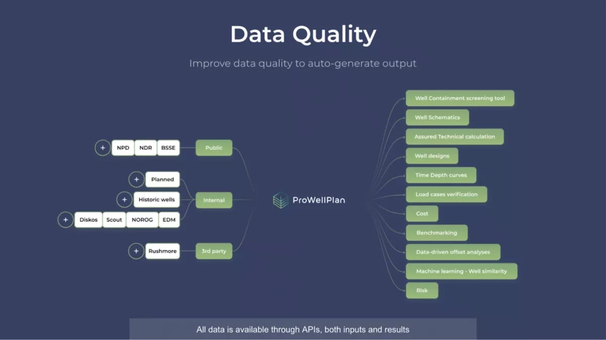
What kind of data can you find at Pro Well Plan software?
Our platform allows us to easily integrate with any public or private database. We also create your reports and QC your data, so you can invest in analysing and improving your wells.
Would you also be able to do well designs and offset reviews in hours instead of months? Feel free to reach us at our website or LinkedIn account.
.webp)