Minimizing the risk of drilling a dry hole is a critical challenge in the oil and gas industry. Dry holes are costly in terms of financial investment. One way to reduce the risk of drilling a dry hole is to implement data-driven decision-making processes.
Data-driven decisions involve using historical data, current data, and predictive modeling to determine the most likely locations for successful drilling. This process involves analyzing geological formations, drilling logs, and production history. Using this approach, operator companies can reduce the risk of drilling dry holes by pinpointing the most promising drilling locations. This approach can also improve efficiency by reducing the number of wells that need to be drilled.
Pro Well Plan is a tool that is specially created to help engineers, managers, and decision-makers to tailor their critical decision based on facts and data. It is helping companies to visualize and analyze their scattered and unsorted data with a single click, which otherwise takes weeks to search and sort. Its core competency is the flawless flow of data between multiple stakeholders of a project.

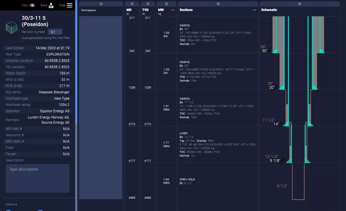
Equinor drilled a wild cat well 30/3-11 S (Poseidon) in the Norwegian sea that went dry. The well has been drilled using the Deepsea Stavanger, a semi-submersible rig up to the vertical depth of 4625 meters (from RKB) in the Drake Formation of the Middle Jurassic period.
You can view the full-page schematic which is generated using Pro Well Plan.
In the oil and gas industry, one of the key challenges is finding, structuring, and visualizing the relevant data for critical decisions making. By using Prowellplan, a tool with a structured database that contains detailed information on historic drilling activities, operators can gain advanced insights into data by searching and visualization with a single click.
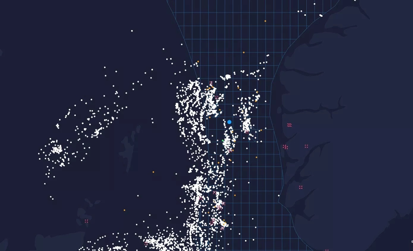
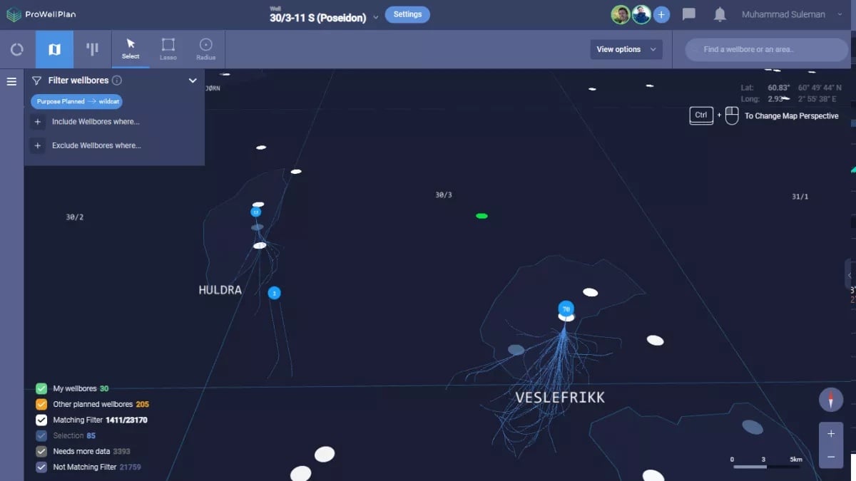
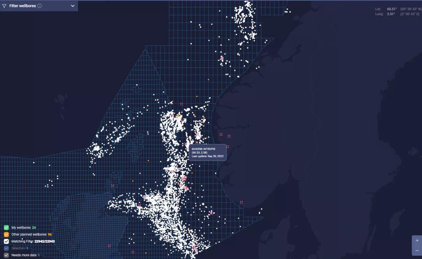
By reviewing well logs and historical data, engineers can make informed decisions on drilling plans to optimize drilling performance and minimize the cost of a wildcat well. Screenshots below shows the example of data visualization of nearby wellbores of 30/3-11 S (Poseidon) well in Norwegian sea.

Get in contact with us to unleash new opportunities with PWP software!
.webp)